Day 3 (July 21, 2020): Up the Pen'!
Neither of us had ever been further north on the Great Northern Peninsula than the entrance to the famous Western Brook Pond, in the northern section of Gros Morne. So it was with great excitement that we set off from Rocky Harbour at 8:30AM, destination St. Anthony on the northern tip. In our elementary school geography course, we clearly recall it being referred to as the Great Northern Peninsula, although it tends to be simply referred to as the Northern Pen these days. As we worked our way north, the appropriateness of including the word 'great' in the name quickly became evident.
We took in some sights in the north of Gros Morne National Park, visited The Arches Provincial Park, absorbed the incredible Norse history of L'Anse aux Meadows, then took in a few of St. Anthony's sights, where we are spending the night.
We had dinner at a local restaurant. There was very little choice, as many restaurants are closed for the full season. As we were about to order, a childhood friend and her husband walked past our table! They had just driven 12 hours straight, from St. John's to St. Anthony. It was great to see them! And we marveled at the size of Newfoundland: that is takes the same time to drive between those two points of the island as it takes to drive from Halifax to Boston or Montreal.
The vastness of the Northern Pen really strikes you when you drive north for the first time. And the few people that populate such a vast land mass is also quite obvious. Even with the devastating COVID impact on tourism, the numbers of people visiting the world-class sights of the Northern Pen is small. A place like The Arches would be crawling with tourists, if it were located in Europe, and admission would be expensive. Here, it was free, and we had the park to ourselves.
This was an amazing day for us on the Northern Pen. Tomorrow, we take the ferry to the Labrador Straits area.

The stunning mountains rising from the famous Western Brook Pond. We were so pleased to have taken the tour of the fjord in 2013. All boat tours have been cancelled this summer.

Just past Sally's Cove, are the iron remnants among the rocks of the S.S. Ethie, which ran into the rocks during "the worst storm ever" in 1919. All survived, and a baby was sent ashore in a mail bag!

Parks Canada has restored a summer fishing camp at Broom Point. The three Mudge brothers and their families fished here from 1941-75

The Mudge brothers' old out house at Broom Point.

The sand-duned beach at Shallow Bay, within the National Park, seems as if it was transported from the Caribbean. Unlike the Caribbean, though, the water rarely gets above 15C.

North of Parsons Pond, the Arches Provincial Park presents a huge monument to the carving power of the ocean.

The Arches.

The Arches.

Also at the Arches.

Wild flowers at The Arches Provincial Park.


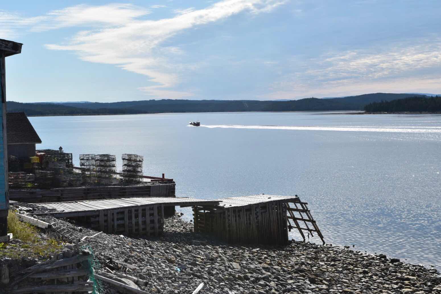
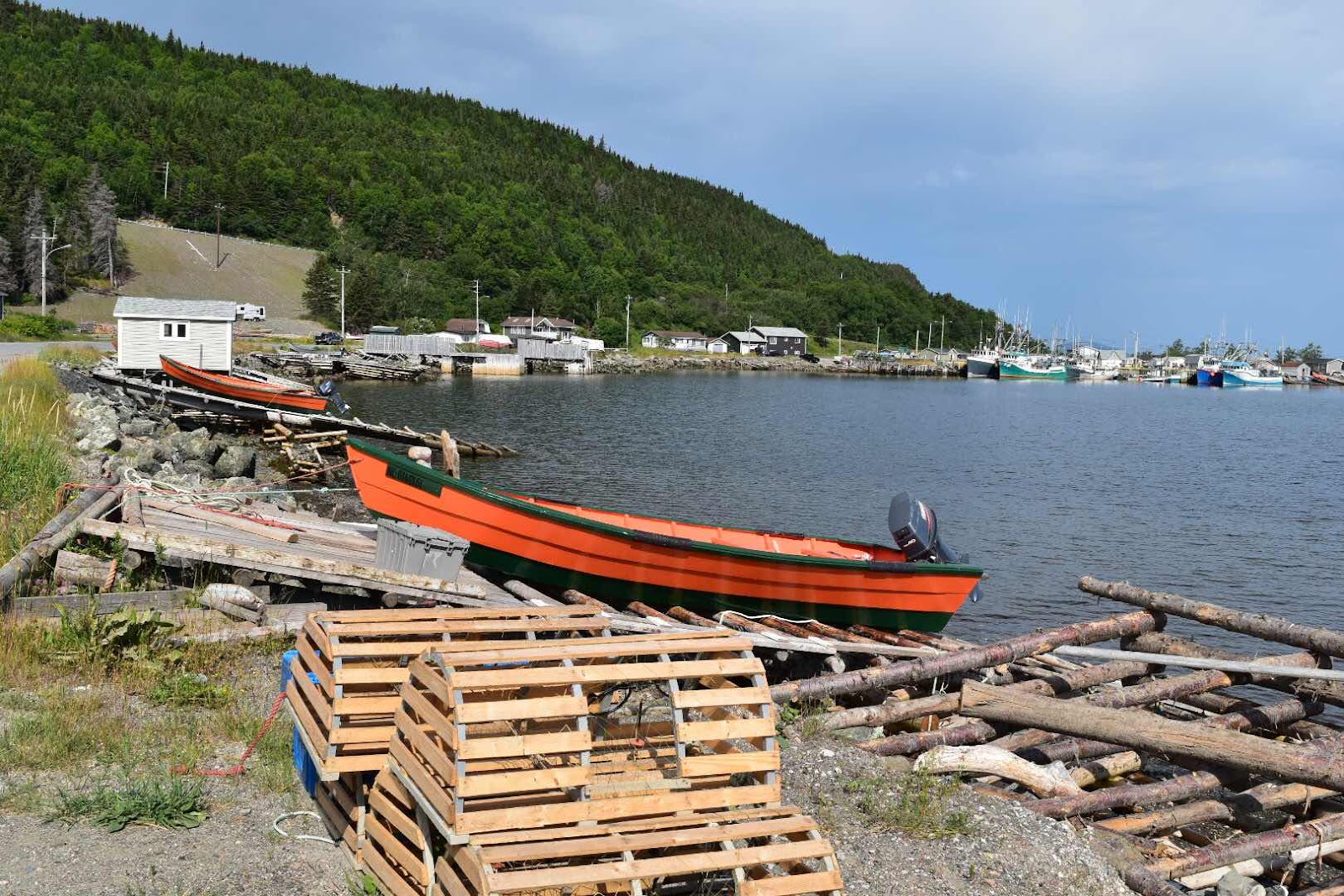
Much of the 220KM from the northern boundary of Gros Morne National Park to Eddie's Cove, where Route 430 heads inland and across the Peninsula towards St. Anthony, hugs the ocean closely. The route winds along past fishing villages, sand dunes and rugged coastline.

Once Route 430 turns inland at Eddie's Cove, the landscape changes: tundra and stubby trees become the norm.

Saint Lunaire-Griquet, near L'Anse aux Meadows.

And finally, we arrived at L'Anse aux Meadows, where the Norse Vikings are widely believed to have landed just before 1000 AD. This is one of Newfoundland's top tourist sites, and is a place we have wanted to visit all our lives.

L'Anse aux Meadows.

Anne Stine and Helge Ingstad from Norway, made the Viking discovery at L'Anse aux Meadows in 1960. Parks Canada built on their amazing archaelogical digs in the 1970s and 1980s. This is a copy of the original busts of Anne and Helge, which we saw in Norway a few years ago.

The Vikings destroyed their original settlement at L'Anse aux Meadows, when they terminated the camp, possibly due to conflict with the indigenous people. The footprints of their sod buildings remain, but three of them were reconstructed by Parks Canada and beautifully depict the Norsemen's life.

The sod longhouse.

The site is animated by several Parks Canada staff, who carry out daily tasks from the lives of the Vikings.


Inside the longhouse.


The Parks Canada staff told us that, as of 3PM, there had been 60 visitors today. Normally, this part of July would see 400-500 visitors.

A nearby statue of Lief Erikkson, who was the leader of the Norse group that discovered "Vinland" - the Norses' name for L'Anse aux Meadows.

And then it was on to St. Anthony, where the mark of Wilfrid Grenfell, who arrived from England in 1892 and passed away in 1941, is still deeply imprinted on the community.

Grenfell's home in St. Anthony.


Grenfell's living room.

The kitchen.

Grenfell's office.

A trail leads up from Grenfell's home to an excellent viewpoint over the community.

Some of St. Anthony's historic structures.


The provincial Natural Resources office has this bear trap sitting on the parking lot - a reminder that this remote part of the Peninsula is home to many four-legged creatures.

The Fox Point Lighthouse, at the opening to St. Anthony's harbour.

Fishing Point, near the opening to the St. Anthony Harbour.

Looking towards the opening of St. Anthony's harbour.

Perfect clouds over Groasis Island in the distance.
We took in some sights in the north of Gros Morne National Park, visited The Arches Provincial Park, absorbed the incredible Norse history of L'Anse aux Meadows, then took in a few of St. Anthony's sights, where we are spending the night.
We had dinner at a local restaurant. There was very little choice, as many restaurants are closed for the full season. As we were about to order, a childhood friend and her husband walked past our table! They had just driven 12 hours straight, from St. John's to St. Anthony. It was great to see them! And we marveled at the size of Newfoundland: that is takes the same time to drive between those two points of the island as it takes to drive from Halifax to Boston or Montreal.
The vastness of the Northern Pen really strikes you when you drive north for the first time. And the few people that populate such a vast land mass is also quite obvious. Even with the devastating COVID impact on tourism, the numbers of people visiting the world-class sights of the Northern Pen is small. A place like The Arches would be crawling with tourists, if it were located in Europe, and admission would be expensive. Here, it was free, and we had the park to ourselves.
This was an amazing day for us on the Northern Pen. Tomorrow, we take the ferry to the Labrador Straits area.
The stunning mountains rising from the famous Western Brook Pond. We were so pleased to have taken the tour of the fjord in 2013. All boat tours have been cancelled this summer.
Just past Sally's Cove, are the iron remnants among the rocks of the S.S. Ethie, which ran into the rocks during "the worst storm ever" in 1919. All survived, and a baby was sent ashore in a mail bag!
Parks Canada has restored a summer fishing camp at Broom Point. The three Mudge brothers and their families fished here from 1941-75
The Mudge brothers' old out house at Broom Point.
The sand-duned beach at Shallow Bay, within the National Park, seems as if it was transported from the Caribbean. Unlike the Caribbean, though, the water rarely gets above 15C.
North of Parsons Pond, the Arches Provincial Park presents a huge monument to the carving power of the ocean.
The Arches.
The Arches.
Also at the Arches.
Wild flowers at The Arches Provincial Park.
Much of the 220KM from the northern boundary of Gros Morne National Park to Eddie's Cove, where Route 430 heads inland and across the Peninsula towards St. Anthony, hugs the ocean closely. The route winds along past fishing villages, sand dunes and rugged coastline.
Once Route 430 turns inland at Eddie's Cove, the landscape changes: tundra and stubby trees become the norm.
Saint Lunaire-Griquet, near L'Anse aux Meadows.
And finally, we arrived at L'Anse aux Meadows, where the Norse Vikings are widely believed to have landed just before 1000 AD. This is one of Newfoundland's top tourist sites, and is a place we have wanted to visit all our lives.
L'Anse aux Meadows.
Anne Stine and Helge Ingstad from Norway, made the Viking discovery at L'Anse aux Meadows in 1960. Parks Canada built on their amazing archaelogical digs in the 1970s and 1980s. This is a copy of the original busts of Anne and Helge, which we saw in Norway a few years ago.
The Vikings destroyed their original settlement at L'Anse aux Meadows, when they terminated the camp, possibly due to conflict with the indigenous people. The footprints of their sod buildings remain, but three of them were reconstructed by Parks Canada and beautifully depict the Norsemen's life.
The sod longhouse.
The site is animated by several Parks Canada staff, who carry out daily tasks from the lives of the Vikings.
Inside the longhouse.
The Parks Canada staff told us that, as of 3PM, there had been 60 visitors today. Normally, this part of July would see 400-500 visitors.
A nearby statue of Lief Erikkson, who was the leader of the Norse group that discovered "Vinland" - the Norses' name for L'Anse aux Meadows.
And then it was on to St. Anthony, where the mark of Wilfrid Grenfell, who arrived from England in 1892 and passed away in 1941, is still deeply imprinted on the community.
Grenfell's home in St. Anthony.
Grenfell's living room.
The kitchen.
Grenfell's office.
A trail leads up from Grenfell's home to an excellent viewpoint over the community.
Some of St. Anthony's historic structures.
The provincial Natural Resources office has this bear trap sitting on the parking lot - a reminder that this remote part of the Peninsula is home to many four-legged creatures.
The Fox Point Lighthouse, at the opening to St. Anthony's harbour.
Fishing Point, near the opening to the St. Anthony Harbour.
Looking towards the opening of St. Anthony's harbour.
Perfect clouds over Groasis Island in the distance.

Another great day of exploration with great photos! Lovely weather too!
ReplyDeleteThanks for reading the blog, Juliet!
Delete